Dec 26, 2015
Station Trends Based on the RRWT Average Correlation Wavelength
I added a new test specimen. I want to compare the group velocity wavelength method versus the average wavelength method. In order to do so I needed data and decided to implement the average wavelength method into a Station Trend output like I currently have for the group velocity method. The forecast data for the average wavelength method can be found here. I will be conducting verification on both methods. On a side note, the average wavelength method acts as a numerical genesis for the Lezak Recurring Cycle and the Doug Heady Pattern cycle length. This means anyone can forecast like Gary or Doug as the LRC/HP cycle length is automatically generated on a daily basis, all year round. If there are any questions, comments, or suggestions on the material presented please let me know.
Dec 11, 2015
The Evolution of the Daily Trend - Suggested Weather Pattern to Begin 2016
In early September I Tweeted the January 2016 Daily Trends for Wausau, Milwaukee, Madison, and Oshkosh.
The Daily Trends showed a time period of below average temperatures for all locations to begin the new year. Since that day, the CONUS weather pattern correlation envelope has evolved daily. This group velocity is monitored in standing wave notation, so I would expect that the Daily Trends wouldn't change all that much.
With the Bering Sea Rule showing a storm to impact the ECONUS, I felt it time worthy to look at what the Daily Trends currently have in store for the new year.
The Daily Trends model run of 12/10 shows a similar pattern response but the temperature amplitude from average is less dramatic. The overall idea now is that temps will remain at or above average, instead of 5 to 7 degrees below average. We shall see!
In regard to the storm, below are possible Recurring Rossby Wave Train systems, based on current individual correlation waves of ~70 and ~50 days. If there are any questions, comments, or suggestions on the material presented please let me know. Click on the images for a larger view. Thanks for reading!

#RRWT freqs since 8/1 suggest a BN start to the new year for #wiwx http://t.co/qlFvUgOAXB @JPWIWX #elnino #rebound pic.twitter.com/ZoF9C0VFsx
— Josh Herman (@OSNW3) September 9, 2015The Daily Trends showed a time period of below average temperatures for all locations to begin the new year. Since that day, the CONUS weather pattern correlation envelope has evolved daily. This group velocity is monitored in standing wave notation, so I would expect that the Daily Trends wouldn't change all that much.
With the Bering Sea Rule showing a storm to impact the ECONUS, I felt it time worthy to look at what the Daily Trends currently have in store for the new year.
Animated GIF: The GFS modeled #BSR suggests a system will affect the ECONUS to start 2016. (See image) pic.twitter.com/QLppcnEMRJ
— Josh Herman (@OSNW3) December 10, 2015The Daily Trends model run of 12/10 shows a similar pattern response but the temperature amplitude from average is less dramatic. The overall idea now is that temps will remain at or above average, instead of 5 to 7 degrees below average. We shall see!
In regard to the storm, below are possible Recurring Rossby Wave Train systems, based on current individual correlation waves of ~70 and ~50 days. If there are any questions, comments, or suggestions on the material presented please let me know. Click on the images for a larger view. Thanks for reading!
Dec 7, 2015
WARNING: #Christmas #Weather
WARNING: #Christmas #weather Tweet. Per #BSR and #RRWT. More info at link: https://t.co/E4nU7Rmoqs pic.twitter.com/Bqn20gRvaF
— Josh Herman (@OSNW3) December 7, 2015Click the forum link in the Tweet above. It will provide a 15 second read of what I was thinking with the posted images. If there are any questions, comments, or suggestions on the material presented please let me know.
Nov 11, 2015
Seasonal Variation of a Signature Rossby Wave Train
Oh and of course, the July version, 7/5, ~45 days from 8/19. But, it's a new pattern! Lol. Easy to follow https://t.co/Rbo9ApVzHI @OSNW3
— Josh Herman (@OSNW3) November 11, 2015Above is a Tweet designating dates of previously high correlated patterns for the storm occurring in the middle of the CONUS on 11/11/15.
(US Radar Loop). The image below depicts the correlation frequencies of the recurring RWT and focuses on the significant disturbance. Click on the image for a larger view. (bigger yet)
If there are any questions, comments, or suggestions on the material presented please let me know. Click on the images for a larger view. Thanks for reading!
Nov 10, 2015
Western Great Lakes Region 2015-16 Winter Forecast Snapshot (DJFM)
The Framework: Utilize NOAA/ESRL Radiosonde Database to analyze large-scale upper atmosphere patterns in standing wave notation. Described specifically to harmonics, reflecting the temporal/transient behavior of the frequency wavelengths in correlation and relating Intraseasonal Oscillation to Mid-Latitude recurring weather patterns. The Goal: Forecast skill of upper-air and surface weather trends. The Test: Recurring Rossby Wave Train.
As of November 10, 2015 two dominant frequencies of correlation are identifiable. A low 30 and mid 40 day wavelength. Simply put, my model projects based on the weather pattern correlation standing wave behavior. Forecasts and analyses of this behavior can be found here. If more indepth information is desired I often Tweet and post on the AccuWx Forums.
Western Great Lakes Region 2015-16 Winter Forecast Snapshot (DJFM)
If there are any questions, comments, or suggestions on the material presented please let me know. Click on the images for a larger view. Thanks for reading!
Oct 22, 2015
The OSNW3|WxClimate Correlation Wave Fundamental Frequency, Harmony, and Phase Change
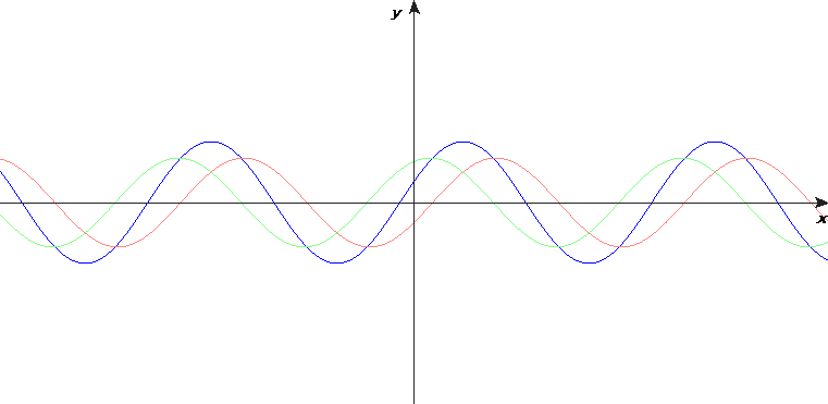
For a while now I have been connecting the weather pattern recurrence correlation to a standing wave formation. In the heatmaps and charts below I can see fundamental frequency, harmony, and phase change. The transient behavior of the frequency wavelengths is also evident when using them to project the weather pattern as shown by a recent timeline of forecast output.
If there are any questions, comments, or suggestions on the material presented please let me know. Click on the images for a larger view. Thanks for reading!
Hey @dlhmnwx30, what defines an Indian Summer? Is one on the way? pic.twitter.com/wK554PaaXX
— Josh Herman (@OSNW3) October 15, 2015My focus is the MW/S/SE in the 16-20 day. ULL progression per #BSR and BN temp anomalies per #RRWT. #weather pic.twitter.com/WQiP13bWVS
— Josh Herman (@OSNW3) October 20, 2015Aww, jeez. Model has gone all in with low 30s frequency. I can't get upset though, R is > 0.57 for all modes. #RRWT pic.twitter.com/GagaWr32VD
— Josh Herman (@OSNW3) October 21, 2015If there are any questions, comments, or suggestions on the material presented please let me know. Click on the images for a larger view. Thanks for reading!
Oct 13, 2015
A Quick Ramble. An Example of Pattern Correlation.
What do I mean when I mention pattern correlation? The chart below shows the H5 for Oakland, CA and the linear connection of two cycles. Top frequencies in the region have hovered in the mid 50s for nearly a month. Oct-12 top frequency for Oakland, CA was 54 days, the correlation result was 0.63.

The H5 values are not supposed to match, but instead parallel each other. If there are any questions, comments, or suggestions on the material presented please let me know. Click on the images for a larger view. Thanks for reading!

The H5 values are not supposed to match, but instead parallel each other. If there are any questions, comments, or suggestions on the material presented please let me know. Click on the images for a larger view. Thanks for reading!
Oct 9, 2015
A Modeled H5 Sub 520 in the Bering Sea at Forecast Hour 144
I am anxious to see what the RRWT model comes up with. The time frame will be coming into focus with the 21-25 day very soon.
ECMWF 500mb 144

Recurring Rossby Wave Train Frequency

~37 Days Ago

~54 Days Ago

Either way, this BSR moment caught my eye. Did a touch of quick research and this is what I came up with. Sniff it out, deets come later.
If there are any questions, comments, or suggestions on the material presented please let me know. Click on the images for a larger view. Thanks for reading!
Sep 7, 2015
Testing of the Recurring Rossby Wave Train Continues
The 2015-16 website is located here. I've scaled down the amount of station trends I provide on the website. I sort of upped the ante with forecasts utilizing ESRL mapping techniques. I have partnered with some others to use their frequency and run it through my framework and push the results back to them. I am providing plenty of pattern correlation analysis as well. It's still fun I guess. If there are any questions or concerns about any of the material please leave a comment or email me.
I have provided links to the evolution of this farcical process. Each year it evolves, and I am looking forward to what I learn this year.
2014-15
2013-14
2012-13
2011-12
2010-11
I have provided links to the evolution of this farcical process. Each year it evolves, and I am looking forward to what I learn this year.
2014-15
2013-14
2012-13
2011-12
2010-11
Aug 4, 2015
The Fickle Nature
The other day I made a comparison using the RRWT and BSR to showcase a potential NW flow into the ECONUS during the second half of August.
Since then, due to the volatility of recent plots, I decided to publish the frequencies that are used to generate the maps for perhaps a more thorough analysis. Below is a snap shot in time.
RRWT

And as we see per the BSR, moving into the third week of August the NW flow is not there.
BSR

I think the RRWT frequency on 7/30 was an anomaly of sorts, showcasing harmonics. We shall see. If there are any questions, comments, or suggestions on the material presented please let me know. Click on the images for a larger view. Thanks for reading!
Hints of a NW flow into the ECONUS per #RRWT and #BSR second half of August. pic.twitter.com/JCLRLt0H15
— Josh Herman (@OSNW3) July 31, 2015Since then, due to the volatility of recent plots, I decided to publish the frequencies that are used to generate the maps for perhaps a more thorough analysis. Below is a snap shot in time.
RRWT
And as we see per the BSR, moving into the third week of August the NW flow is not there.
BSR
I think the RRWT frequency on 7/30 was an anomaly of sorts, showcasing harmonics. We shall see. If there are any questions, comments, or suggestions on the material presented please let me know. Click on the images for a larger view. Thanks for reading!
Aug 3, 2015
Using the PNA Frequency to Project CONUS Temperature
A while back I decided to begin finding the frequency of the PNA and AO as I had been for the 500mb in the CONUS. Now I need to verify the PNA/AO frequency can be used to capture past weather conditions in order to project future weather conditions. I will attempt such in this post, using the PNA.
I correlate the frequency (recurring patterns) of the PNA. Recently the high frequency has been ~37 days and the low frequency has been ~70 days. See image below.

The frequency is transient and pulses slowly back and forth (animation) Starting from a point in time; Aug-1. I want to verify the high frequency of this past cycle, 6/25-8/1, to two cycles ago 5/23-6/25. Knowing the average high frequency we can project forward. 5/23-6/25 should resemble what was to come 6/25-8/1.
5/23-6/25

6/25-8/1

With this comparison it seems the trough axis shifted a bit west, but overall it's not a bust. I want to verify the low frequency also. The low frequency as of this writing is ~70 days. The frequency is transient, and after analyzing the frequencies of a cycle previous, 3/14-5/23, I feel the need to shorten the range by ~5 days going back another cycle.
3/19-5/23

5/23-8/1

The low frequency PNA from 3/19-5/23 did OK projecting the time frame of the next low frequency cycle 5/23-8/1. Certainly not a bust.
If there are any questions, comments, or suggestions on the material presented please let me know. Click on the images for a larger view. Thanks for reading!
I correlate the frequency (recurring patterns) of the PNA. Recently the high frequency has been ~37 days and the low frequency has been ~70 days. See image below.
The frequency is transient and pulses slowly back and forth (animation) Starting from a point in time; Aug-1. I want to verify the high frequency of this past cycle, 6/25-8/1, to two cycles ago 5/23-6/25. Knowing the average high frequency we can project forward. 5/23-6/25 should resemble what was to come 6/25-8/1.
5/23-6/25
6/25-8/1
With this comparison it seems the trough axis shifted a bit west, but overall it's not a bust. I want to verify the low frequency also. The low frequency as of this writing is ~70 days. The frequency is transient, and after analyzing the frequencies of a cycle previous, 3/14-5/23, I feel the need to shorten the range by ~5 days going back another cycle.
3/19-5/23
5/23-8/1
The low frequency PNA from 3/19-5/23 did OK projecting the time frame of the next low frequency cycle 5/23-8/1. Certainly not a bust.
If there are any questions, comments, or suggestions on the material presented please let me know. Click on the images for a larger view. Thanks for reading!
Jul 11, 2015
Fundamental Frequency
A changing of the guard? Notice the temporal elongation of frequency, ~30 transitions to ~35 and ~60 transitions to ~70. A phasing of the wave is taking place with a moderate ~40 now showing up.

This paints an anomalously warm ECONUS the next few weeks, with a late July, early Aug reprieve.

My calcs are showing an upper 40s for a Lezak/Heady style cycle length. A forecast value going above 50 as we head through September. I wonder what these guys will come up with through Summer and into Fall. Both of their blogs are listed in the Blog Roll on the right.

If there are any questions, comments, or suggestions on the material presented please let me know. Click on images for larger views. Thanks for reading!
This paints an anomalously warm ECONUS the next few weeks, with a late July, early Aug reprieve.
My calcs are showing an upper 40s for a Lezak/Heady style cycle length. A forecast value going above 50 as we head through September. I wonder what these guys will come up with through Summer and into Fall. Both of their blogs are listed in the Blog Roll on the right.
If there are any questions, comments, or suggestions on the material presented please let me know. Click on images for larger views. Thanks for reading!
Jul 10, 2015
The Recurring Rossby Wave Train and Bering Sea Rule Working Together
Are the RRWT and BSR techniques on to something? The time frame in question is the end of July and the beginning of August.
Bering Sea Rule Technique

Recurring Rossby Wave Train Technique

If there are any questions, comments, or suggestions on the material presented please let me know. Click on images for larger views. Thanks for reading!
Bering Sea Rule Technique
Recurring Rossby Wave Train Technique
If there are any questions, comments, or suggestions on the material presented please let me know. Click on images for larger views. Thanks for reading!
Jul 7, 2015
Random Verification
I did a quick verification on my forecast maps that use the ESRL mapping. I picked a random projection range. 6/29-7/3. See the observed surface temp in attached image. Projection images listed below. (more here).

us-t2125-20150608-20150629-20150703
us-t1620-20150613-20150629-20150703
us-t1115-20150618-20150629-20150703
us-t0610-20150623-20150629-20150703
Seems my short-term forecasts 6-15 days were off a bit in this instance. The 16-25 days did OK. If you need help decoding the file name list above, see this link.
If there are any questions, comments, or suggestions on the material presented please let me know. Click on images for larger views. Thanks for reading! #workinprogress
May 4, 2015
Using the Bering Sea Rule to Predict Severe Weather Events and Verifying the Prediction with the Recurring Rossby Wave Train
The images in the Tweet below show the Bering Sea Rule correlation to the CONUS. Based on our research (page 46), Shemya, AK connects to Columbia, MO. The premise is that observed weather in the Bering Sea region shows up in the CONUS 17-21 days later. Click on the Tweet below to see the larger images. (More predictive data related to BSR here)
JD suggests deep south and wants a harmonic relationship based on the Recurring Rossby Wave Train.
The PNA has been cycling ~32 days. (click on PNA) As far as the CONUS 500s, strong correlation exists in these windows as well. (click on REGIONAL+). Seems that fancy LRC length has been showing up in the REGIONAL+ the past 10 days too. Harmonics for everyone.
Getting to the point.
~May 20 going back ~32 days...
150416_rpts
150417_rpts
150418_rpts
150419_rpts
~May 20 going back ~LRC days...
150331_rpts
150401_rpts
150402_rpts
150403_rpts
~May 20 going back ~64 (nothing special)
150318_rpts
150319_rpts
The current frequency and harmonic certainly show a possibility. I know JN has been using late Oct as an analog for his version of the LRC lately. If you go back to Nov 16, it could connect to ~May 20, if you like averaging 185 days to find the wheelhouse prophecy. On a side note, going further into the future with the GFS, #chasecation2015 might get sucked into a vortex.
If there are any questions, comments, or suggestions on the material presented please let me know. Thanks for reading!
Potential severe weather events ~May14 & ~May20 based on #BSR? What do you think @TriStatesWx and @jnelsonweather? pic.twitter.com/BWI50VQhy9
— Josh Herman (@OSNW3) May 3, 2015JD suggests deep south and wants a harmonic relationship based on the Recurring Rossby Wave Train.
The PNA has been cycling ~32 days. (click on PNA) As far as the CONUS 500s, strong correlation exists in these windows as well. (click on REGIONAL+). Seems that fancy LRC length has been showing up in the REGIONAL+ the past 10 days too. Harmonics for everyone.
Getting to the point.
~May 20 going back ~32 days...
150416_rpts
150417_rpts
150418_rpts
150419_rpts
~May 20 going back ~LRC days...
150331_rpts
150401_rpts
150402_rpts
150403_rpts
~May 20 going back ~64 (nothing special)
150318_rpts
150319_rpts
The current frequency and harmonic certainly show a possibility. I know JN has been using late Oct as an analog for his version of the LRC lately. If you go back to Nov 16, it could connect to ~May 20, if you like averaging 185 days to find the wheelhouse prophecy. On a side note, going further into the future with the GFS, #chasecation2015 might get sucked into a vortex.
@islivingston @TriStatesWx @jnelsonweather let the hilarity ensue. See yellow box. #BSR #GFS :) pic.twitter.com/z0dtuAEBlX
— Josh Herman (@OSNW3) May 3, 2015If there are any questions, comments, or suggestions on the material presented please let me know. Thanks for reading!
Apr 17, 2015
High Correlation in the Mid 30 Day Frequency
I am currently recording near 0.8 correlation in the mid 30 day frequency in Region 7. I plotted the 500s for two stations (KILX and KILN) in what I label Region 7 to show the pattern consistency. Region 7 consists of stations in the Ohio Valley (Central). This region has all stations reporting within the daily top 10 frequencies.


I would suspect that if someone analyzed CONUS 500 maps during this time frame there would be regions that do not match up within this frequency. Analysis suggests that a transient cycle frequency with multiple phasing cycles is taking place. Something similar to a standing wave. Not an all encompassing macro cycle that Lezak suggests. See the heat-map table for more.
Lezak tweeted me that his cycle range has been 43-50 days since 10/1. The chart below shows this range correlating well near the end of November and early December. The wheelhouse time when Lezak discovers his cycle length each year, then back dates it to when it "began" in October. The past few months his range of days hasn't been performing well.

Calculating the median and average of the top-10 daily frequencies yield results very close to what Lezak states as his cycle length range. Most recently the range has been 42-49 days. The chart below shows the range of the median and average since 8/1/14.

If there are any questions, comments, or suggestions on the material presented please let me know. Click on the images for a larger view. Thanks for reading!
I would suspect that if someone analyzed CONUS 500 maps during this time frame there would be regions that do not match up within this frequency. Analysis suggests that a transient cycle frequency with multiple phasing cycles is taking place. Something similar to a standing wave. Not an all encompassing macro cycle that Lezak suggests. See the heat-map table for more.
Lezak tweeted me that his cycle range has been 43-50 days since 10/1. The chart below shows this range correlating well near the end of November and early December. The wheelhouse time when Lezak discovers his cycle length each year, then back dates it to when it "began" in October. The past few months his range of days hasn't been performing well.
Calculating the median and average of the top-10 daily frequencies yield results very close to what Lezak states as his cycle length range. Most recently the range has been 42-49 days. The chart below shows the range of the median and average since 8/1/14.
If there are any questions, comments, or suggestions on the material presented please let me know. Click on the images for a larger view. Thanks for reading!
Mar 15, 2015
A Random ERSL Map Verification Analysis
I am not sure how I will conduct auto verification for these ESRL map type projections. A random case below.
-Surface Temperature Anomaly
-Observed 20150308-20150312

-Surface Temperature Anomaly Forecast
-Initialized 20150215, 21-25 Day Forecast 20150308-20150312

This might look OK, but it is just one instance. I am archiving all of the past projections here. On a side note, I am currently working on auto verification for the Trends. It's a long way off yet, but it is in the works. All of this is an ongoing work in progress. If there are any questions, comments, or suggestions on the material presented please let me know. Thanks for reading!
-Surface Temperature Anomaly
-Observed 20150308-20150312
-Surface Temperature Anomaly Forecast
-Initialized 20150215, 21-25 Day Forecast 20150308-20150312

This might look OK, but it is just one instance. I am archiving all of the past projections here. On a side note, I am currently working on auto verification for the Trends. It's a long way off yet, but it is in the works. All of this is an ongoing work in progress. If there are any questions, comments, or suggestions on the material presented please let me know. Thanks for reading!
Feb 23, 2015
A Transient Cycle Length with Multiple Phasing Cycles
So where was I? Ah yes, I dropped the high amplitude and frequency states (ISO short-term component, 10-20 days) from the CONUS output and plotted the 30-90 day correlations exclusively. More
The map below shows the RAOB stations that I collect data from. I don't collect Canada or Mexico and it seems I randomly do not collect in the deep south US. I blame it on laziness. I am super lazy.

My thoughts are not well organized or educated. They are likely difficult to follow. I will attempt to explain them in short detail. The image below shows which region the highest correlations stem from. The range is 0-1. The higher the value, the more high correlations stem from that region. Example; the daily analysis for 2/21 shows region 5 has 9% of it's stations reporting a top 10 value. Region 8 60% and region 9 67% of it's stations in the top 10. This correlation could be considered "east based", where this region shows the most correlation.

These correlations are charted in a heat-map like table form. The image below shows the first 21 days of February. The left most table is the top 10 cycle lengths, listed from left to right, 1 through 10. The table directly to the right is the corresponding correlation values. The 3 tables to the right are mode, median, and average of cycle lengths for the previous 30 days, since December 1st, and since August 1st. The entire table can be found here.

A quick analysis of the heat-maps suggest a transient cycle length with multiple phasing cycles taking place. Similar to a standing wave. If there are any questions, comments, or suggestions on the material presented please let me know. Thanks for reading!
Framework: Use current NOAA/ESRL Radiosonde Database to analyze large-scale upper atmosphere patterns in standing wave notation. Described specifically to harmonics, reflecting the temporal/transient behavior of the frequency wavelengths in correlation and relating Intraseasonal Oscillation to Mid-Latitude recurring weather patterns.
Goal: Forecasting skill of upper-air and surface weather trends.
The map below shows the RAOB stations that I collect data from. I don't collect Canada or Mexico and it seems I randomly do not collect in the deep south US. I blame it on laziness. I am super lazy.
My thoughts are not well organized or educated. They are likely difficult to follow. I will attempt to explain them in short detail. The image below shows which region the highest correlations stem from. The range is 0-1. The higher the value, the more high correlations stem from that region. Example; the daily analysis for 2/21 shows region 5 has 9% of it's stations reporting a top 10 value. Region 8 60% and region 9 67% of it's stations in the top 10. This correlation could be considered "east based", where this region shows the most correlation.
These correlations are charted in a heat-map like table form. The image below shows the first 21 days of February. The left most table is the top 10 cycle lengths, listed from left to right, 1 through 10. The table directly to the right is the corresponding correlation values. The 3 tables to the right are mode, median, and average of cycle lengths for the previous 30 days, since December 1st, and since August 1st. The entire table can be found here.
A quick analysis of the heat-maps suggest a transient cycle length with multiple phasing cycles taking place. Similar to a standing wave. If there are any questions, comments, or suggestions on the material presented please let me know. Thanks for reading!
Framework: Use current NOAA/ESRL Radiosonde Database to analyze large-scale upper atmosphere patterns in standing wave notation. Described specifically to harmonics, reflecting the temporal/transient behavior of the frequency wavelengths in correlation and relating Intraseasonal Oscillation to Mid-Latitude recurring weather patterns.
Goal: Forecasting skill of upper-air and surface weather trends.
Doug Heady Joins Gary Lezak at Weather2020
Great to read that Heady and Lezak are back together. Gary puts together a wicked map comparison in a recent blog. Can someone point out 4 similar features in the maps just 9 days prior to this latest map comparison? I have provided the map analogs below.


I find it fascinating what Gary and Doug see. If there are any questions, comments, or suggestions on the material presented please let me know. Thanks for reading!
I find it fascinating what Gary and Doug see. If there are any questions, comments, or suggestions on the material presented please let me know. Thanks for reading!
Feb 13, 2015
I dropped the high amplitude and high frequency states and plotted the 30-90 day correlations exclusively
I dropped the high amplitude and frequency states (ISO short-term component, 10-20 days) from the CONUS output and plotted the 30-90 day correlations exclusively.

What is this junk? Back when I followed Lezak's Recurring Cycle and/or the Heady Pattern, comparing 500mb maps with the naked eye was the only way to find/follow the cycle. I quickly learned everyone has a different eye. Instead of looking for blessings from the cyclic masters I decided to seek the cyclic nature in data. Much like how they (LRC/HP) compare maps I decided to compare legitimate peer reviewed oscillations in a similar manner. Rather than look for a recurring cycle at ~50 days every couple days (or what is perceived as the cycle length) in maps, I formulate correlation of a 10 to 90 day range from sounding data on a daily basis. I find the dominant recurring patterns and plot the output.
A correlation example. Say I am finding the correlation for the date 9/1, for day 20 in the 10-90 day range. The data arrays that are used to find the correlation consist of data within the dates 9/1 thru 8/12 and 8/11 thru 7/22. I find the correlation for day 10 through day 90 and plot the highest correlations. This is what is plotted in the tables of the image above. The left table is the region* the top correlations in the middle table originated from, the middle table is the top 10 oscillation frequencies (aka "cycle" length) and the right table is the corresponding correlation value of the middle table. At the very bottom of the table is mode, mean, and average statistics as well.
*I categorize the CONUS RAOB stations in regions of climate. I simply label them region 1 through 9, see image below.

Framework: Use current NOAA/ESRL Radiosonde Database to analyze large-scale upper atmosphere patterns in standing wave notation. Described specifically to harmonics, reflecting the temporal/transient behavior of the frequency wavelengths in correlation and relating Intraseasonal Oscillation to Mid-Latitude recurring weather patterns.
Goal: Forecasting skill of upper-air and surface weather trends.
This is just quick summary that stemmed from this twitter thread. I will likely add to the entry in the future. If there are any questions, comments, or suggestions on the material presented please let me know. Thanks for reading!
What is this junk? Back when I followed Lezak's Recurring Cycle and/or the Heady Pattern, comparing 500mb maps with the naked eye was the only way to find/follow the cycle. I quickly learned everyone has a different eye. Instead of looking for blessings from the cyclic masters I decided to seek the cyclic nature in data. Much like how they (LRC/HP) compare maps I decided to compare legitimate peer reviewed oscillations in a similar manner. Rather than look for a recurring cycle at ~50 days every couple days (or what is perceived as the cycle length) in maps, I formulate correlation of a 10 to 90 day range from sounding data on a daily basis. I find the dominant recurring patterns and plot the output.
A correlation example. Say I am finding the correlation for the date 9/1, for day 20 in the 10-90 day range. The data arrays that are used to find the correlation consist of data within the dates 9/1 thru 8/12 and 8/11 thru 7/22. I find the correlation for day 10 through day 90 and plot the highest correlations. This is what is plotted in the tables of the image above. The left table is the region* the top correlations in the middle table originated from, the middle table is the top 10 oscillation frequencies (aka "cycle" length) and the right table is the corresponding correlation value of the middle table. At the very bottom of the table is mode, mean, and average statistics as well.
*I categorize the CONUS RAOB stations in regions of climate. I simply label them region 1 through 9, see image below.
Framework: Use current NOAA/ESRL Radiosonde Database to analyze large-scale upper atmosphere patterns in standing wave notation. Described specifically to harmonics, reflecting the temporal/transient behavior of the frequency wavelengths in correlation and relating Intraseasonal Oscillation to Mid-Latitude recurring weather patterns.
Goal: Forecasting skill of upper-air and surface weather trends.
This is just quick summary that stemmed from this twitter thread. I will likely add to the entry in the future. If there are any questions, comments, or suggestions on the material presented please let me know. Thanks for reading!
Subscribe to:
Posts (Atom)